Nuke Mexico

What better way to spend a beautiful Sunday morning than listening to a talk about plutonium pits, radioactive leaks, and the possibilities of an accidental, nuclear start to World War III?

1995 aerial TA-3 south to north

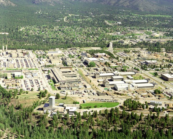
You would never guess that surrounding this complex devoted to nuclear arms is some of the most striking scenery in northern New Mexico.

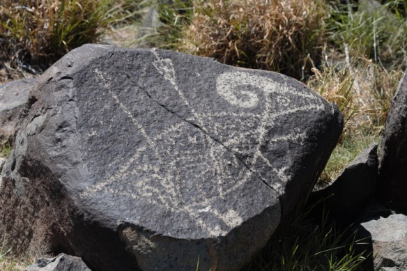
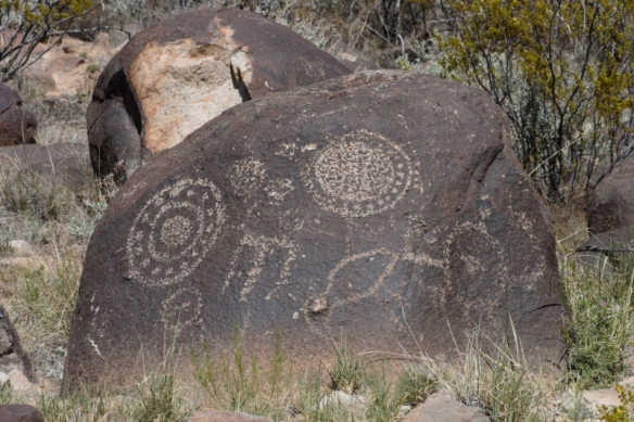
Welcome to New Mexico, where since World War II the state has been at least partially defined by its historical and ongoing role in bringing us nuclear weapons. Say Los Alamos, and most people (or am I being too optimistic?) can probably identify it as the birthplace of the atomic bomb. They might even know that the first A-bomb was successfully tested some several hundred miles to the south near Alamagordo (they’re less likely to know about the Downwinders, the New Mexicans exposed to fallout from the blast, who are still seeking compensation for their related health ills). But outside of New Mexico, I doubt few people keep tabs on the ongoing nuclear arms development that takes place at Los Alamos National Laboratory (LANL) and, to a lesser extent, at Sandia, a national lab in Albuquerque. And outsiders probably don’t have the same concern about the still-closed Waste Isolation Pilot Plant (WIPP) in Carlsbad, which suffered two accidents in 2014, but which could, when it’s reopened, take on nuclear waste from around the United States and perhaps other countries as well.

Greg Mello of the Los Alamos Study Group (LASG) knows all about New Mexico’s nuclear history and LANL and WIPP and the billions of dollars the government plans to spend over the next few decades to modernize its nuclear weapons—with the most important work going on at LANL. A co-founder of LASG, Mello drew a sizable crowd into a Santa Fe book store today for a talk titled “Crawl Out Through the Fallout: LANL and the Future of Santa Fe.” His talk went beyond Santa Fe to look at what he would consider, I think, one of our state’s big lies: that the New Mexico economy needs both national laboratories to survive. Our elected officials in Congress seem to think so, and none of them have called for slowing down or reversing the push to build more and more advanced nuclear arms. Mello and some in the audience singled out Senator Tom Udall, considered a liberal on most issues, for wrongly supporting the labs at all costs.

I had bought the economic-necessity argument for the labs, and even Mello’s own numbers show that some people would be hurt if LANL disappeared. About 1/3 of its approximately 10,000 employees don’t have college degrees. Could they get jobs with the same security and benefits if the lab closed? And given the past actions and current ambitions of Russia and China, some would argue that the United States would be foolish to stop investing in its nuclear arsenal. LANL is at the heart of that effort, helping to design and build weapons hundreds of times more powerful than the first atomic bombs.

But Mello argued that overall, since the end of World War II, the billions of dollars spent at LANL have not helped Santa Fe or New Mexico. That money and the research done at the labs have not kept the state from staying at or falling to the bottom of the barrel when it comes to important economic indicators. Together the labs employ only 2 percent of the state’s workforce, and although the PhD researchers are well paid, the money does not necessarily benefit the state as a whole. And while Mello did not say much about this, the people who have benefited include execs at Bechtel and other members of the public-private consortium that runs the lab (the folks who got the blame for the WIPP accidents and were recently cited for other safety violations. But hey, what are a few accidents if we can cut corners and make more money?).

pit

LANL produces most of the country’s plutonium pits, the “triggers” in today’s thermonuclear weapons.

In an era of what Mello called “continuous war,” he and LASG are working for what many might think is a pipe dream: nuclear disarmament. But the group is also concerned about environmental safety—particularly as it relates to nuclear waste—social justice, and economic sustainability. Mello called on the audience to get involved, especially by letting elected officials know that they oppose the growing efforts at LANL to expand our nuclear arsenal. Speak out, he said, against the “myth of defense,” that we can spend our way to greater security. (To a degree, Mello suggested, the government sees our defense spending as part of overall U.S. efforts at deterrence, an attempt to show potential foes we’ll go to any length to ensure military dominance and control “all aspects of the escalatory ladder.”) Realize, Mello said,  that companies like Bechtel lobby Congress to pursue policies that fatten their bottom lines, while putting us at risk of an arms race without end and exposure to environmental hazards.

The New START nuclear arms agreement with Russia runs out in 2021. What will follow? We don’t know. I’m sure if Mello has his way, the United States will end its efforts to build more powerful and stealthy nuclear cruise missiles, which are helping to fuel the new arms race. I left the talk thinking that nuclear disarmament is a great idea, but are the other members of the “club” going to buy it?

Regardless of what happens in Washington, I think most people here would agree that it’s a little scary living so close to a place where plutonium is prepared to kill perhaps millions of people, and waste products of all kinds sit in heaps and leach into our water. Others believe, as Mello does, that it’s also unethical.

We live in a beautiful place, but the spectre of a nuclear accident—or the thought that we are a very juicy target if a nuclear attack ever came—is not a comforting one.

And how was your Sunday morning?

On the Rocks

After spending too much time at my computer and not enough exploring the expanses of the Land of Enchantment, I finally set off on road trip this past weekend, to the Three Rivers Petroglyph Site, north of Tularosa in the southern part of the state. I went as part of a Meetup group that explores historical and cultural sites around New Mexico, with an emphasis on being outdoors and hiking as much as possible. It was a bit of a crapshoot, committing to spend almost 12 hours with three total strangers, but the conversation flowed easily and Charles, the leader of the group, is a dedicated hiker with a lot of knowledge about the history and geography of the areas he selects for the group to explore. I’m looking forward to another adventure with this crew.

On this trip, we headed south on back roads (at least compared to the interstate), and I saw a lot of terrain I had never seen before. The landscape changed several times, moving through grasslands and patches of juniper. We went through the town of Encino, which, if not officially classified as a ghost town, could be. The Census Bureau says it has fewer than 100 people, but I don’t think we spotted any of them as we passed through. Nearby Vaughn (population 446) showed more signs of life, but it also had a lot of empty and dilapidated buildings along the main road. If I had been alone, I would have stopped to take pictures of some of the derelict structures; I’m thinking of a return photo expedition around sunset someday soon.

After a slight navigational error, we backtracked a bit and headed south toward Tularosa, passing through “historic” Carrizozo. The claim to historic fame seems to rest on the region’s ties to Billy the Kid (Carrizozo is the county seat of Lincoln County, where the Kid took part in the Lincoln County Wars and achieved his notoriety as an outlaw) and to Albert Fall, who played a significant part in the Teapot Dome scandal and owned a ranch in the area. (As you’ll see through the link, he has the dubious distinction of being the first presidential cabinet member ever convicted of a crime while in office.)

Finally we reached the petroglyph site, which is administered by the Bureau of Land Management. The rock carvings were the work of the Jornada Mogollon, who came to the region around 900 CE. The Mogollon, whose name comes from a Spanish governor of colonial New Mexico, lived along what is now the U.S.-Mexico border from southeastern Arizona across New Mexico. They first settled in the region a little more than 2,000 years ago. In the Three Rivers areas, the Jornada left behind some 21,000 petroglyphs, depicting animals, crops, human features, and abstract symbols.

IMG_6329 (2)_1_1IMG_6347 (2)_1_1IMG_6349 (2)_1_1IMG_6370 (2)_1_1IMG_6377 (2)_1_1IMG_6391 (2)_1_1

IMG_6396 (2)_1_1

Another guest at the site that day.

At the site, with the Sacramento Mountains to the east and the San Andres Mountains to the west, a short hike up to the rocks revealed carvings of different sizes. From the higher points, we could see in the distance what looked like snow, but was actually the White Sands National Monument (another trip for another day). We climbed over the rocks, took lots of pictures, then sat in the shade and talked about other sights to see in the future and trips the other members of the group had already taken together.

We took a different route back, which led us through the town of San Antonio, where signs indicated that the road could be closed, because of missile testing at the White Sands Missile Range. No tests that day, thankfully, and we reached I-25 just south of Albuquerque to begin the trip back to Santa Fe. It was a day of lovely weather, history, and good company; what more could you ask for?

Exploring Chaco

As I’ve written before, it was a work project on the Taos Pueblo that first spurred my curiosity about New Mexico and led to my first visit in 1996, which led to the obsession—a healthy one, for a change—to someday move there. Writing about New Mexico several times after that first assignment, including for Scholastic’s America the Beautiful series, introduced me to other parts of the state’s diverse, sometimes awe-inspiring geography and rich history.

Fajada Butte, near the entrance to the canyon.

Fajada Butte, near the entrance to the canyon.

One place that I wrote about several times was Chaco Culture National Historical Park, more commonly known as Chaco Canyon. This remote spot west of Santa Fe was once the center of a thriving Native American culture, whose residents are the ancestors of today’s Puebloan people, many of whom consider it sacred land, as do some Navajo.

IMG_4792 (2)_1Not a city per se, Chaco was more of an administrative, commercial, and ceremonial center for different peoples of the regions. They traded with Indians all over the Southwest and into Mexico and communicated over vast distances using signal fires. The ancestral Puebloans also built roads into the canyon that linked Chaco with other communities; they oriented buildings to the seasonal positons of the sun and moon; and they erected massive “great houses” of unprecedented size for the region using only simple stone tools. The remains of the great houses are what attract most visitors today. I went as part of a tour sponsored by the University of New Mexico and so learned a lot about the archaeology and history while exploring the ruins.

Part of Pueblo Bonito

Part of Pueblo Bonito

The largest of the great houses was Pueblo Bonito, with some 600 rooms, though not all of them were inhabited at once. Construction on Bonito began some time during the 800s. The building process there and at other Chaco great houses sometimes went on for several centuries. Exploring the lives of the people who lived there continues today, though at times it can take archaeologists decades to process what they learn from the artifacts and offer explanations for how and why the Chacoans lived as they did. As to why they left the canyon: drought may have played a role, compounded by internal political conflict or invasions by hostile tribes. But it seems clear that by 1200 the Chacoans had mostly abandoned their great houses and moved on.

Wildflowers abounded

Wildflowers abounded

And some members of the group found pottery shards

And some members of the group found pottery shards

Just as the Chacoans looked to the sky for celestial markings, today’s nighttime visitors can enjoy a beautiful panorama of stars and planets. Chaco has earned the Dark Sky Place designation from the International Dark-Sky Association, which educates about light pollution and the need to preserve dark skies. But Chaco Canyon is also facing a threat from companies seeking to extract oil and natural gas from the surrounding countryside. Driving out there, I could see new wells and roads popping up all over the area. The Bureau of Land Management said at the end of 2014 that it would hold off on issuing more leases for extraction—for now. But in a state starved for jobs, the battle to limit fracking and other activities near Chaco is most likely not over.

For now, though, visitors can explore the park by day and star gaze at night and still have a sense that they’re experiencing a great part of New Mexico’s past.

Dark Spot on the Enchanted Circle

You head north out of Taos, past the roads for the pueblo and the Rio Grande Gorge. You hit Route 522 and you’re on it—the Enchanted Circle, a road that loops around the area’s major mountains, including New Mexico’s tallest, Wheeler Peak. If you’re lucky, like I was last weekend, you set out in late September, when the aspens are starting to turn, painting the mountainsides yellow amidst the evergreens.

Aspens just outside of Questa

Aspens just outside of Questa

When you reach Questa, the circle curves east onto Route 38. To your right, more of the aspens shimmering in the still-emerging sunlight, with glimpses of the Red River along the way. And to the left—well, let’s just say a corporate presence has tainted that side of the circle.

New Mexico, the Land of Enchantment with its Enchanted Circle, relies on its natural beauty to attract tourists, who contribute greatly to the economy. And while some local folks might consider some of the outsiders a necessary evil—spend your money and then get the hell back to Texas—they don’t leave behind the kind of environmental devastation  Chevron has left in Questa.

Along the Red River, on the other side of the street.

Along the Red River, on the other side of the street.

I first learned about Questa earlier this year, when I read that Chevron’s molybdenum mine there was closing, costing the community about 300 much-needed jobs. That’s the reality in a poor state like New Mexico: extraction industries provide some of the best employment opportunities, even as they befoul the earth. Where will those 300 people go for work? How will lives be affected—perhaps even destroyed? I don’t have the answers, and I feel for those people, even as I hope that closing the mine will help restore the beauty on that side of the road, like the kind you can see on the other.

Chevron plans to tear down the mill.

Chevron plans to tear down the mill.

The first thing I noticed by the mining site was the color of the ground—yellow, in a chalky way, not like the almost golden-hued aspens. Then there was the sign announcing the site belonged to Chevron, followed by the empty mining mill close to the road.

What I didn’t see were the tailing ponds on the other side of Questa, where over the years Chevron dumped more than 100 million tons of tailings, or water and waste from the mining process. The tailings traveled through a nine-mile-long pipe, with some leaking out along the way. As the EPA put it, breaks in the pipe “resulted in the spilling of into and along the flood plains of the Red River, threatening [a] fishery and nearby endangered species habitats.” Other pollution from the mine has contaminated surface and ground water in the area. The principal pollutants, the EPA said, include arsenic, lead, molybdenum, and zinc.

moly-pit

A birds-eye view

The government put the Chevron site on the National Priorities List of Superfund Sites in 2011. The company began cleaning up waste the next year, and the work continues. This effort will “allow EPA to mitigate threats to public health and the environment from the release or potential release of hazardous substances, pollutants and contaminants.” But what about the damage already done? The mining in Questa started almost 100 years ago, and acid-generating waste rock has been sitting around the pit for several decades. Chevron admits it can’t control seepage from the tailing ponds, and the environmental group Amigos Bravos lists a number of problems the mining operation has caused over the years.

And let’s not forget the damage done to workers. In 2013 mining employee Isaac Garcia was killed, caught between two rail cars carrying ore. While human error doubtlessly played a part, the Mine Safety and Health Administration placed some blame on “management’s failure to ensure that established safe procedures were followed while Garcia worked between ore cars…. Additionally, the braking systems on the locomotive were not maintained in functional condition.”

While Chevron cleans up the site, the scars on the earth and the poisons in the water remain. By one estimate, this effort could cost up to $1 billion. Meanwhile, many out-of-work miners are still looking for jobs, though union rep David Trujillo said Chevron seemed to be doing the best it could, under the circumstances, to help out.

I knew only a little of this story as I passed the abandoned mine on my way around the Enchanted Circle. But I had a feeling that the mine was not a source of environmental good, even as it provided jobs and the company made contributions to local charities. Now, Chevron will move on. The pollution, at least for a time, will remain. And New Mexicans will continue to debate how to balance the economic good the extraction industries provide while trying to mitigate their environmental impact. At least I hope they will. Unfortunately, the prospect of four more years of a pro-business, anti-environment governor who feeds at the trough of the Koch brothers might color the debate.

The City Historical

Astride his horse, Don Diego de Vargas solemnly rides down the street toward the Plaza, with a train of conquistadors behind him, just as he did more than 300 years ago at the first Fiesta de Santa Fe.

Well, not quite.

Conquistadors of today

Conquistadors of today

IMG_3814_1

in Santa Fe

The good don was eight years departed from this earth when the first fiesta was held. And the modern-day de Vargas I was watching will put aside his costume and horse at the day’s end. But the real de Vargas was the inspiration for the procession that paraded by me.

He had promised to honor the Virgin Mary as represented by a wooden statue called La Conquistadora, which had been brought to Santa Fe in 1625. It was her blessing, de Vargas thought, that enabled him to take back Santa Fe in 1692-94, after the Pueblo Revolt of 1680 had driven the Spanish from northern New Mexico (you can read more about the revolt and the reconquest in previous posts). While de Vargas was not able to carry out his pledge to build a new throne for the statue, one of his captains suggested the idea of a fiesta to mark the restoration of Spanish rule and the beneficence of La Conquistadora.

As a historian by trade if not by academic degrees, I’m always appreciative of living in a state, and particularly this part of it, that is steeped in history, and which the people with deep familial roots consistently celebrate. And some Santa Feans and Pueblo Indians who surround the city have roots that few Americans today can match. It’s not uncommon to hear the former talk about being the 14th, 17th, 20th generation of their family in the area, and of course the Pueblos go back even further.

palace

One conjecture about how a two-story Palace looked.

To mark Fiesta week, the sponsoring council holds an annual history lecture. I attended this year’s and the hall was packed. Dedie Thomas Snow, an archaeologist who has participated in digs at Santa Fe’s Palace of the Governors (built in 1609), spoke about the palace’s history from 1660-1720, when it often was, as her talk’s title spelled out, “A Palace in Need of Repair.” The one-story building that dominates the plaza today went through structural changes during those years, including gaining additional stories during the years the Pueblos controlled it.

Along with the history of the building, Snow talked a bit about the early social history of Santa Fe and the region. Original settlers who received land grants took part in the encomienda system—they also received Indian labor or tribute in return for military service in the colony, defending mission pueblos. The Spanish colonists established estates near the missions, and many of the villages that eventually grew up around them still exist today.

The Palace today, festooned for Fiesta

The Palace today, festooned for Fiesta

The founding landowners, by law, also spent time in Santa Fe, and the leading citizens lived on small farms near the Plaza, north of the Santa Fe River. On some of the farms, the colonists raised peaches, which Spanish missionaries had earlier brought to North America. South of the river, the Barrio de Analco sprung up to house working-class settlers and Indian laborers.

Much of the Barrio de Analco was destroyed during the Pueblo revolt, though a church built on the foundation of one of the oldest churches in the United States, dating back to the barrio’s founding in 1620, still stands. The barrio is also the site of Santa Fe’s oldest existing house, which dates from the mid-18th century.

Hmm, 1620—I seem to recall some other settlers making news that year about 2,000 miles away. Something about a rock…

The talk was a little slow in places, but I always enjoy learning a little bit more about my adopted home. And I know there will be another talk next year, just as there will be another Fiesta celebration. Tradition and history cling to the City Different, but in a way not stifling, but invigorating. Que viva La Fiesta!